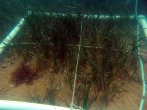
 (2010 – 2012) BENTHIC HABITAT MAPPING, LONG ISLAND – NY, OAK BLUFFS – MA, NEW BEDFORD – MA:
BenthIc habitat mapping utilizing hypack survey software, underwater high-resolution towed video/light system with laser scaling, and still photography. Underwater surveys identified substrate types and localized marine flora and fauna. Surveys were performed on behalf of project engineers and in support of dredge permitting associated with beach replenishment operations and marine terminal construction projects.
